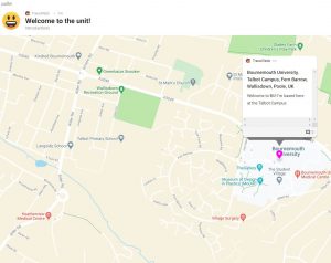
Padlet is a popular tool to promote collaboration and engagement with students but did you know you can easily add maps to your Padlets?
The maps format displays a map of the world on which you can pin posts containing any of the usual range of Padlet content, including text, files, images, weblinks or videos. It allows you to zoom in and out so you can focus on the whole world or just your location and is a great visual way to display information.
So how could you use this feature with your students?
- Create a Padlet map as a Welcome Introduction for new students. Students and staff could pin their location and post a short introduction to themselves.
- Start to build a community by sharing ideas for places to visit in the area around the university.
- Map events to show places of historical, political or social interest.
- Share media and comments from field trips, pinned to the locations where they were created.
- Post questions about aspects of geography for others to respond to.
You can learn more about Padlet maps with some examples of ideas for their use from the Padlet support website and the Padlet blog.


